As indicated in previous post (December 11, 2021), my journey in Greece from Dimitsana onward continued as hike mostly on feet, with myself as only company. An imprecise map helped me define Adritsaina as next ‘goal’, and I had the sun, time and a compass as lead. The Arcadian hills grown with small greek oak trees were hot and dry. The day passed without meeting any bipeds, and only a greek turtle crossed my path.
Mountains in ArcadiaGreek tortoise (Testudo graeca) encounter underway
After mid-day, I had to take care not to get over-heated, but some rivers provided refreshment at times.
In hammock of Bardaki (Μπαρδάκι) I was invited – when filling water bottle at local pump – to have retsina and tomato salad in plenty olive oil on the veranda. The hospitable folks advised a cool moment at nearby river Alfeios.
Bardaki (Μπαρδάκι) houses (1)Bardaki (Μπαρδάκι), the house with veranda
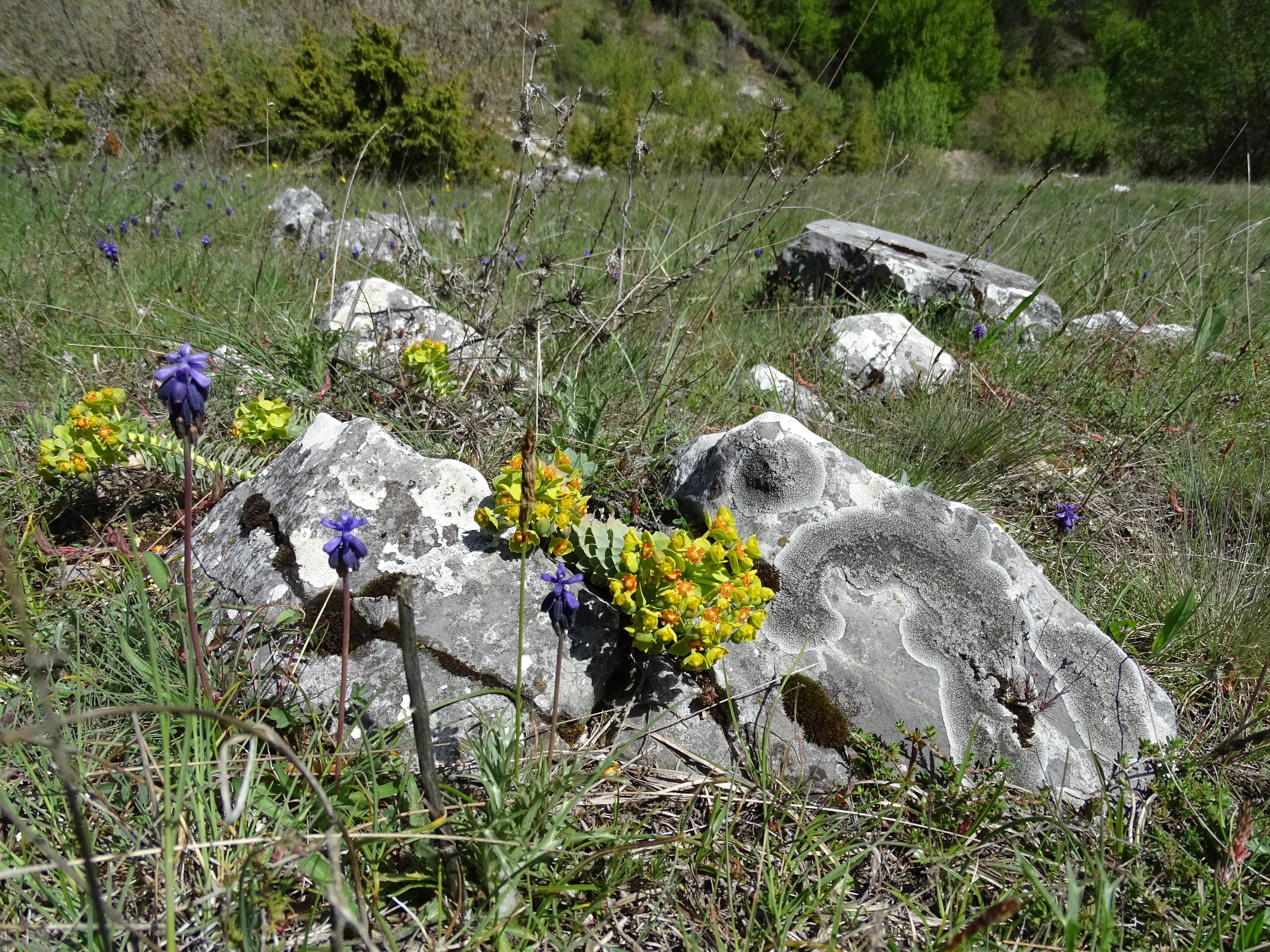
After passing through Andritsaina, and after following a small path through the hills, I came close to a temple with just a few visitors. Some supportive structures had been raised, as an early step towards conservation. It is now an Unesco Monument, and restoration would start in 2001, with a tent (hood) placed over the temple remains. This Temple of Apollo Epicurius at Bassae of Phigaleia has been raised in 5th century BC. In retrospect, the photo is unique with respict to point-of-view.
Temple of Apollo Epicurius at Bassae of Phigaleia, 5th century BC.
At the end of the next day I came to a place, where several big rectangular boulder stones had been neatly arranged providing a plateau to camp. I had arrived at the ancient site of Lycosura (Λυκόσουρα) with the temple of Despoina. At the nearby village an elderly lady had the key to small historic museum, with some big antique statues, and a lot of dust. The entree did cost two drachmes.
Ancient Lykosura (Λυκόσουρα), temple of Despoina (1) Ancient Lykosura (Λυκόσουρα), temple of Despoina (2)
From there the trip continued on feet or by hitch hiking or bus, via Megalopolis to historic Argos, Mycene and coastal city of Nafplion. On the quay outside this city, several young people camped and took a swim in the sea, not bothering to put on cloths between dives. Several times during the day, a ripple of unrest traveled along this quay, when a police officer came to tell nudity would be punished.
View from port of Nafplion to Palamidi Castle (1978)
From Nafplion, a regular buss service brought tourists to ancient Mycene.
Castle of Mycene, with Agamemnon’s Palace in evening light, empty of touristsCastle of Agamemnon, Mycene, the Lion Gate
From Nafplion an easy walk along busy motorway brought me to ancient Argos, with its huge amphiteatre.
Ancient Argos amphitheatre
In the city of Argos, a funeral service was hindered by the defect of historic funeral coach.
Motor trouble of funeral coach (Argos, 1978)
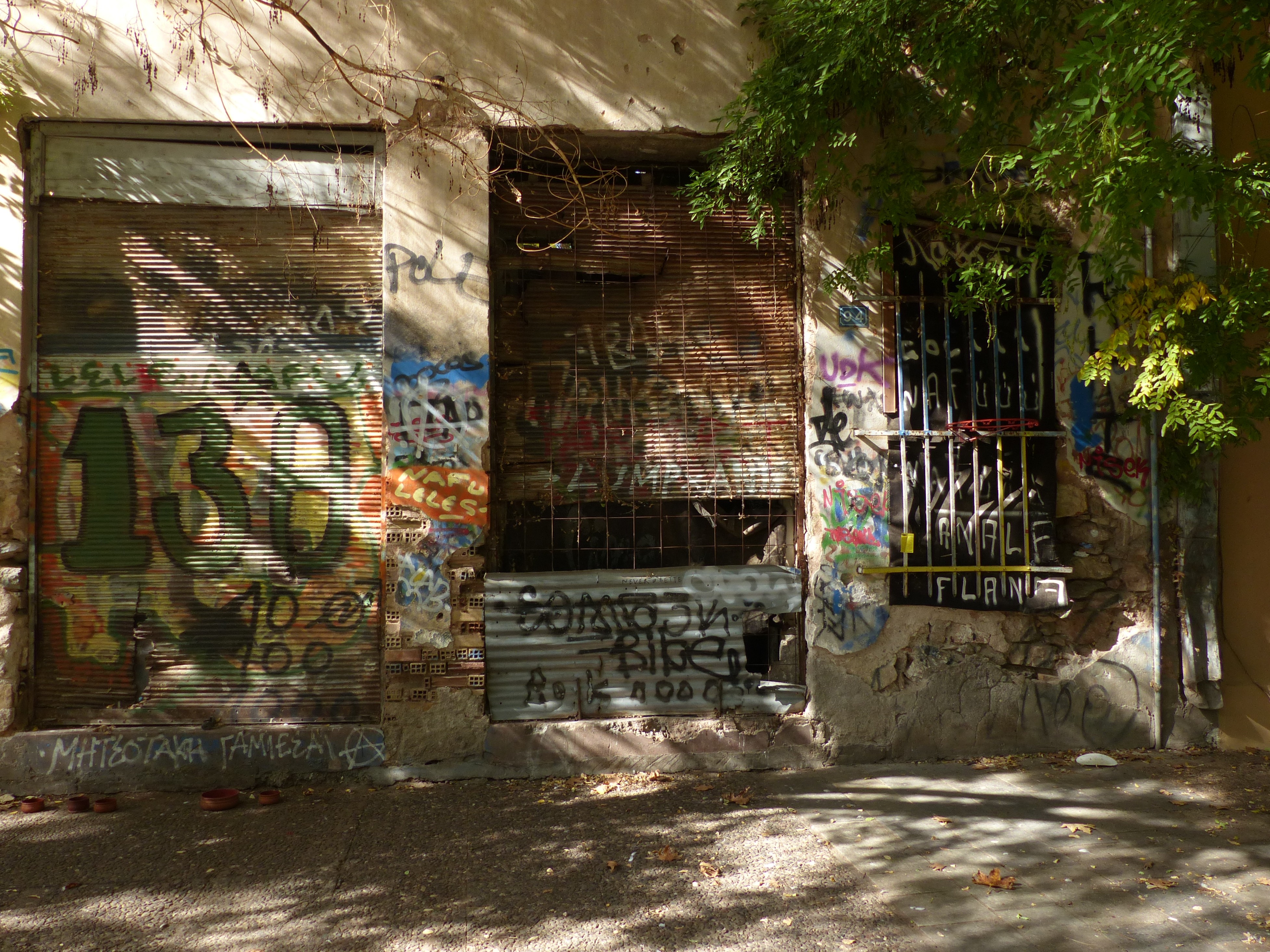
Small garages are scattered all over Greece, like here near Nafplion.
By ferry a short visit was brought to Spetse, the island where the book “The Magus” by author John Fowles is situated. By taking some distance to the tourist crowds, – talking about 1978 – at almost all places something of rural Greece could be found. I walked a few miles from the port, and near the lighthouse I got permission from the guard to camp with my little tent, after having accepted the offer of a glass of ouzo and some fresh tomatoes.
Evening view from lighthouse to port of Spetse.
From Spetse another ferry brought me to Pireas and a bus to Athens, and that is where this story ends.
In July 1978 Jaap, a study pal and mountain hike companion, and I made a journey in Greece. We had trekked in several mountain regions since a few years. After arrival in Igoumenitsa by ferry from Brindisi (Italy), we hitchhiked south to Amfilochia in the back of an open truck.
On the road: blue house and honeysuckleRestaurant (Estiatorion) in AmfilochiaAn evening stroll along the promenade of Amfilochia
The next day brought us to Patras, a city with a history of thousands of years. Already inhabited in prehistoric times, it was an important centre in the Mycenean era. After one night camp there, we continued east to small coastal village of Diakofto.
Patras: fruit seller and Jaap posing for photo.
From Diakofto runs the “Odontotos Rack-railway” to Kalavrita. It was built between 1885-1895 and climbs steeply along a distance of 22 km. We followed a path besides and sometimes on the track, that rises in narrow cleft between steep rocks. At times a viper fled from being trapped on.
Ravin being part of Vourakos Gorge with rail track
In a small cafe in Kalavryta, we were met by suspicion and animosity, expressed by elderly woman rejecting to serve us greek coffee. A younger man could explain to her, we were not German but Dutch, and then the suspicion lessened. All this was related to the big massacre by the nazis in 1943, with over 300 men killed and many houses burned.
Walking further, we heard an one-pit motor and the same young man as mentioned above pointed to a nest with six eggs in the load of three wheeled pick-up motorcycle. This gift was followed by his offer to bring us to Anolousi.Butcher and his wife and slaughtered sheep in Anolousi
Ano Lousi lies on plateau at 1100 m altitude. From here we followed the road to Kata lousi with about as many cars or trucks passing as flocks of sheep.
Plateau with Ano LousiThe road from Ano Lousi to Kato LousiThe author walking from Ano Lousi to Kato Lousi (photo by Jaap)
Near the evening we arrived by foot in the small village of Kastria. We explained our whereabouts, to what appeared to be the village elder, and soon were invited to have a glass of ouzo with several most older men at a table. Later, we were invited to join a party planned to visit the cave that had been discovered nearby, a few years earlier, by a shepherd who had lost a sheep. The party would take ‘William’, a former villager who had emigrated to the USA twenty years earlier, and who had just returned for a visit, to the site, and us alongside.
The entrance of the Kastria Cave
No ticket counter of parking for busses, yet to be seen. We were able to enter the cave for about 300 m, with the guide using an old mining-lamp (Davy lamp) and then were stopped by lakes. Nowadays, walking bridges have been created to gain acces much deeper.
Along the road from Kastria to Langadia: shepherd with milk goats
We hiked further to Klitoria and then to Dafni. On the outskirts of the small village of Dafni, there were more than ten threshing circles. These may have been created two thousand years ago… and are located in areas where the wind blows.
Village of Dafni with many threshing circles.Mule and stake at threshing circle, still in operation.
From Dafni the path led to Langadia, on the busy and touristic road from Olympia to Tripoli. A steep climb to a street 100 m higher brought us back in more rural village atmosphere and we were offered small flat grass plateau for the tent.
Langadia sales man
From Langadia we walked to Dimitsana, about 10 km south. This mountain village at 1000 m height, played important role in Greep revolt against the Turkish occupants. To our great surprise, a Dutch couple arrived soon after we installed our camp outside this village. The surprise became even bigger when they turned out to be neighbours of Jaap. No previous talk about respective travels had been made. The encounter was a pure coincidence…
Historic mountain village of Dimitsana, in 1978
The next day, our path did split, with – Jaap heading for Athens to meet family, and I continued my path alone. This will be part of 2nd blog.
Early autumn 2014, we stayed for some days in big Sun Resort in Greece (Halkidiki, Macedonia). The economic crisis of 2009 had been tempered, but the effects were still visible. Expansion of the resort that had started about eight years earlier, had stopped around 2009-2010, and rapidly, structures that were not finalized got in part demolished.
view from unfinished building to the port and hotel of sun resort
This building stands on the south side of the port. From behind the open, unfinished form is seen. From the harbor, the appearance is ‘better’. A screen suggested a finished structure.
building on the edge of the port, from behind
A little further a second, longer unfinished building.
under construction
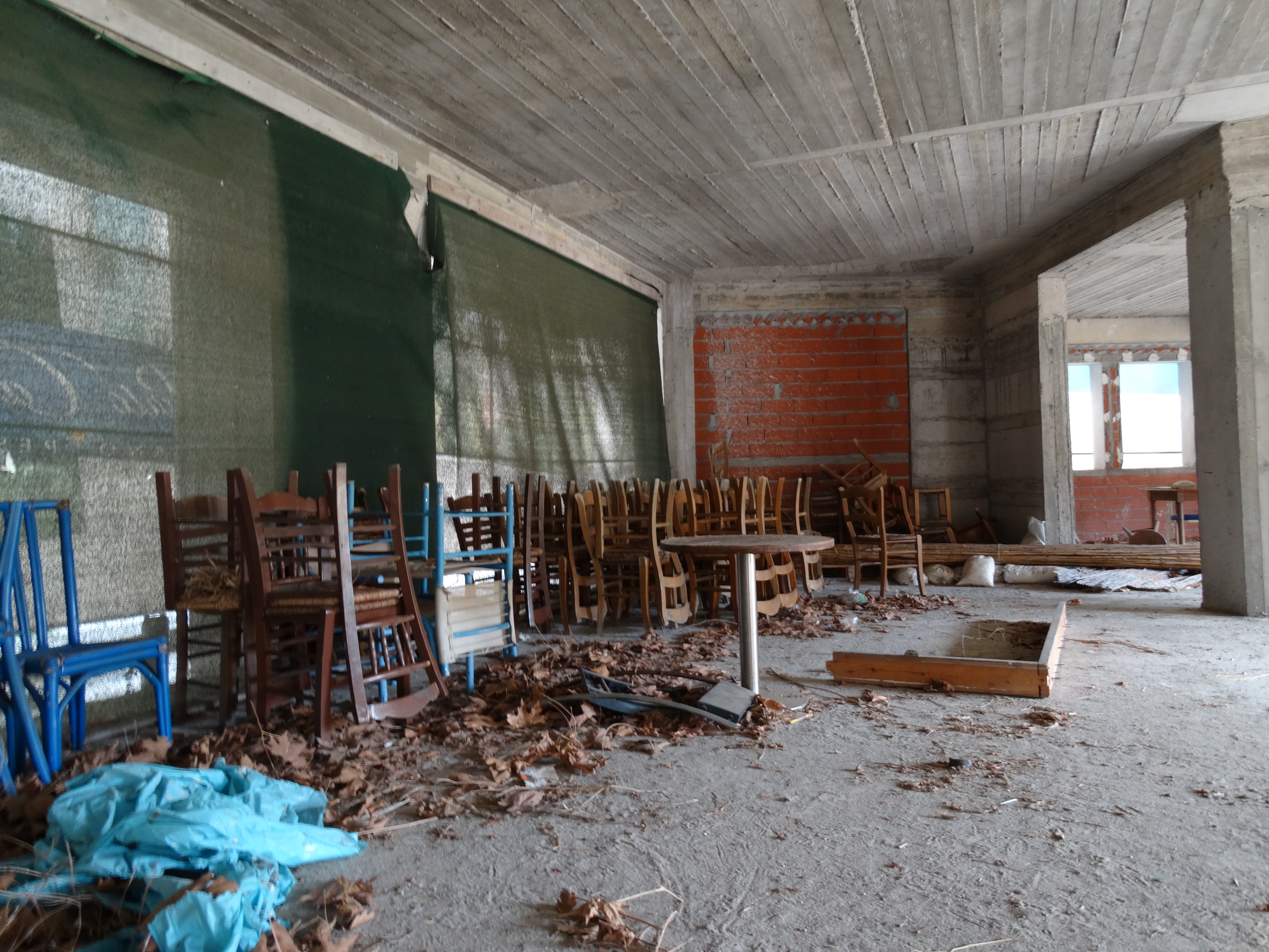
A room of this second building contains stacks of chairs and tables. To the left, again, screens have been placed on which the appearance of a nice finished building is depicted.
furniture
A look from inside through such a screen shows only abstracted forms.
screen in abstraction
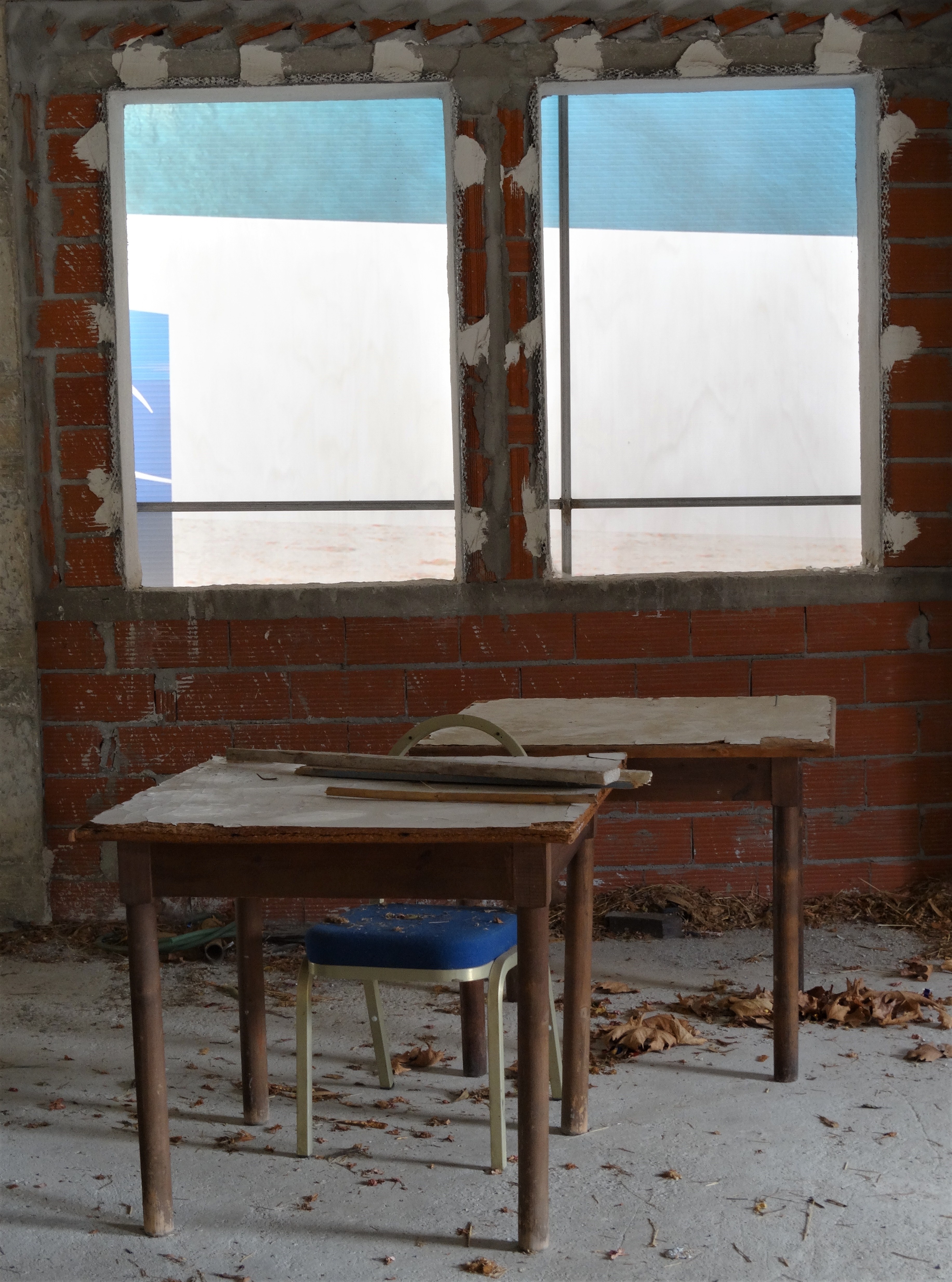
A small, intimate setting.
two tables, one chair
A bit further away from the big hotel and port, attempts to remove old buildings and replace these with new ones, have been suspended. Digging has created a temporary pond.
reflections in time
Note the historic remnants of original dwellings.
past and presence got stuck in time
As part of the expanded sun resort, an open movie theater was created.
on the agenda “Ben Hur”
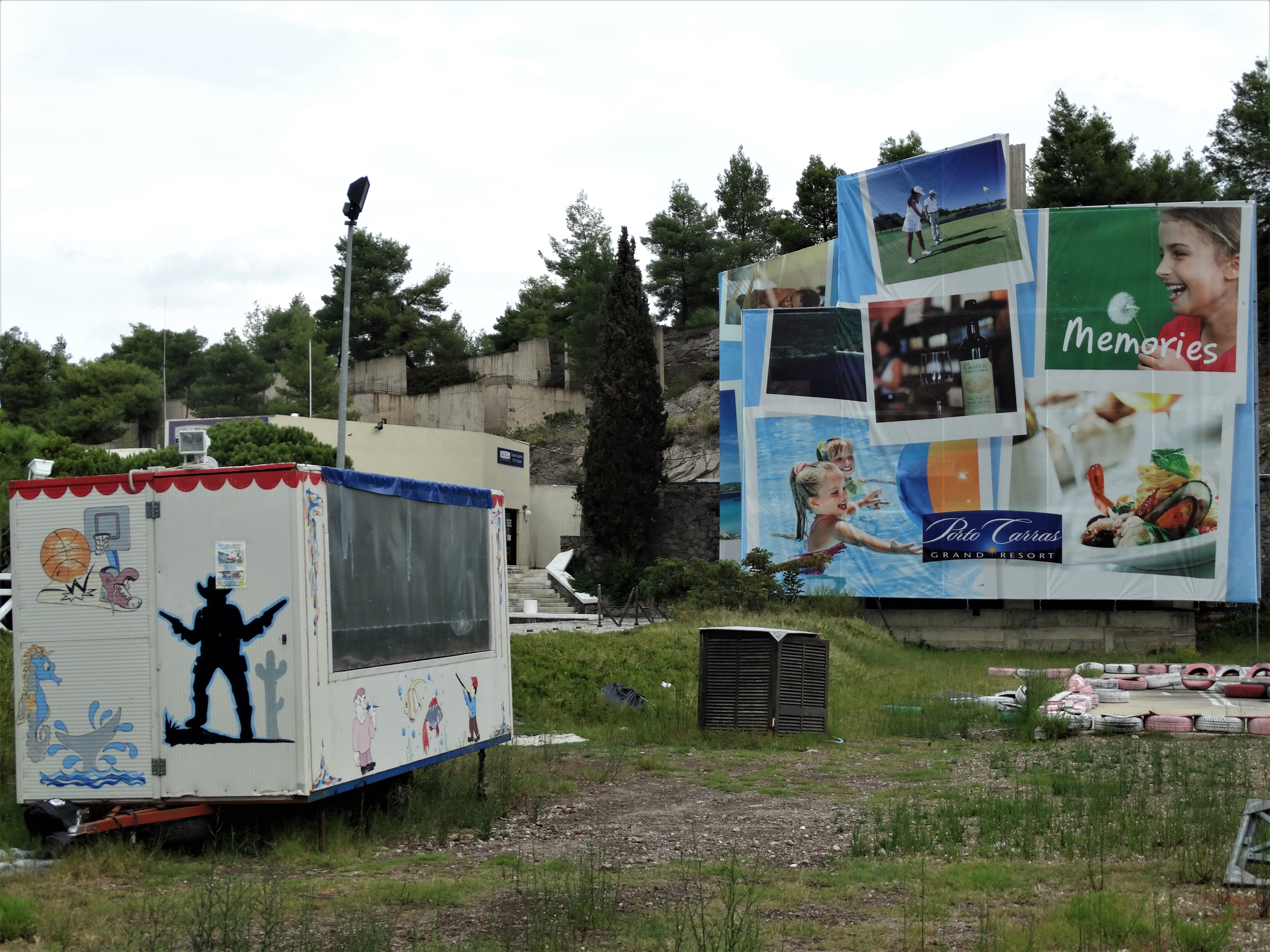
Other play and fun places were installed, but had been abandoned for some time: good for memories.
all what is left…
Now, November 2020, an even bigger crisis has started. This week, news about first effective vaccine against COVID19 arrived. However, expectations are it will take one year or longer, to treat people at risk, which concerns most of us.
No surprise, that situation at this sun resort has remained much the same, in as far I could discern today from examination of google earth map of the area.
In countries like Greece, the visitor must rely on stones to get a grasp of history and important developments of culture.
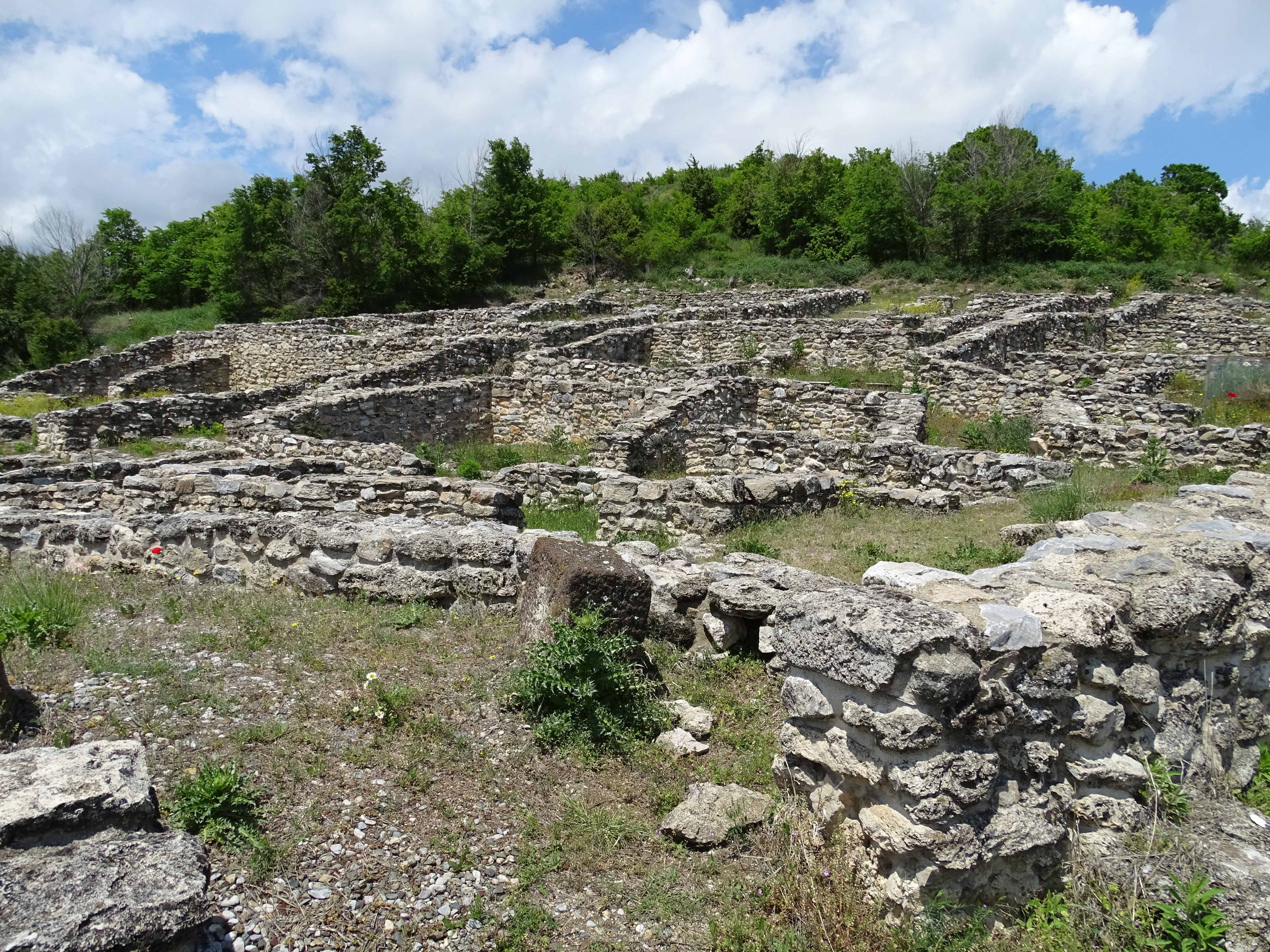
During a short journey in May 2019, In the department of Pella, Macedonia, Greece, we followed signs indicating “Ancient Archeological Site of Petres”.
When arriving there, and having parked the rented car and after walking about 400 m, the most surprising elements to us, were ancient big jars, present in many houses, that had been installed to store water (photo 1).
Looking at the plan of the small city, with rectangular houses, one starts to imagine people walking here, more than two thousand years ago. Discussing family affairs, the harvest, trade, threats… (photo 2).
The firm conclusion was: use talk, or writing, as social medium.
Information about the history of Ancient Petres:
“The ancient city occupies a natural mound to the NW of the village of Petres, in the region of Florina. Its total area reached 15-20 hectares and was protected by a fortification wall built of poros stone. The enclosed area included houses, and public buildings erected in a free layout, separated by streets, 2.5 m. wide. The city was founded in the 3rd century B.C. by Antigonos Gonatas, it flourished in the 2nd century B.C. and it ceased to exist in the 1st century B.C. It was again inhabited in the Roman period, but it moved to a different site.
The archaeological evidence leads to the conclusion that the city owed its development to its strategic position on the Egnatia Road and to its commercial exchanges with other Greek cities. The excavations of the site revealed useful information on the types of the private houses, which were continuously used in north-west Macedonia as late as the 19th century.
Excavations on the site were begun in 1982 and are still in progress, along with restoration and consolidation work of the ancient remains.